Schuylkill County : In Brief
Schuylkill County was created in 1811 from parts of Berks and Northampton counties, and in 1818, land from both Columbia and Luzerne counties was added to the county. Orwigsburg was the original county seat, but in 1831, the seat was moved to Pottsville, which boasted much easier and more efficient railroad and canal connections to all parts of the county. In the late 18th and early 19th centuries, George Shoemaker and Necho Allen were among the first to discover anthracite coal– ‘stone coal’ — in the region. Anthracite coal was originally used for smithing purposes. But its larger usage and impact remained uncertain. Shoemaker, desperate to find a way to monetize his stone coal, made a gamble on the ingenuity of the local population: much of the coal was given away. It was hoped that someone –anyone — would find a use for the coal and, consequently, a path to profits. Finally, it was found to be an efficient fuel for the rolling mills of Delaware County and beyond. The Schuylkill Navigation Company was chartered in 1815 to build a series of navigation improvements in the Schuylkill River. The first shipments of coal by canal were made in the year 1822. Railroads ultimately replaced the canals as the primary means of transporting coal to the markets. Anthracite mining peaked in 1917, and declined throughout the 1960’s, when surface mining began to dominate.
York County : In Brief

Created on August 19, 1749, from part of Lancaster County, York County was named either for the Duke of York, an early patron of the Penn family, or for the city of York in England. Regardless, York was the first Capital of the United States. It was the birthplace of the Articles of Confederation and it was here that the words “The United States of America” were first spoken. York also promotes itself the home of the first Thanksgiving proclamation. The phrase “underground railway” supposedly originated in this southern Pennsylvania area as runaway slaves were assisted in their flight to more tolerant regions. York was very productive in corn, wheat, hemp, and whiskey. Five railroads served the county, and in the 1920s the Lincoln Highway aided truck transportation. Products could be sold in both the Philadelphia and Baltimore markets and, later on, in Pittsburgh as well. Farms cover 48 percent of the land, making York second only to Lancaster County in number of farms.
Westmoreland County : In Brief

Westmoreland County is the second largest county in Pennsylvania. Eighty percent of the landscape is forest and farmland spread over rolling hills. Interestingly, Westmoreland County is located within 500 miles of 70% of the country’s total population. The county was formed by an Act of Assembly on February 26, 1773. The Act also designated that the courts should be held at the house of Robert Hanna, in Hannastown, until a courthouse could be built. The town was burned by Indians on July 13, 1782, but the temporary courthouse was not destroyed. In 1787, despite Hanna’s good fortune, the county seat was moved to Greensburg. The county is home to nationally recognized companies such as Kennametal and Siemens. When Volkswagen took over an unfinished Chrysler plant in 1978, it became the first foreign auto company to build cars in the US since Rolls-Royce manufactured cars here from 1921 to 1931. At its peak in 1981, and before the doors were shuttered in 1987, the Westmoreland assembly produced 200,000 cars. Perhaps the most famous resident of Westmoreland County is the Mellon family, of Mellon Bank fame. Their country home, the Rolling Rock Club, evolved from a riding and fishing retreat into an establishment that at one time boasted trout streams, duck ponds, game birds, shooting ranges and a pack of English fox hounds. The Rolling Rock horse races were run as a charity event from 1934 through 1986. The Latrobe Brewing Company named its signature beer ‘Rolling Rock.’ The number ‘33’ appears on every bottle of Rolling Rock produced, a practoce maintained even after production moved to New Jersey in 2006. For decades, fans of the beer have speculated about the meaning of the number. It is now generally agreed that the “33” signifies the 33 words in the beer’s original pledge of quality, which is still printed on every bottle: ‘Rolling Rock – From the glass lined tanks of Old Latrobe, we tender this premium beer for your enjoyment as a tribute to your good taste. It comes from the mountain springs to you.’
Wayne County : In Brief
Created from part of Northampton County, Wayne County sits in the northeastern corner of Pennsylvania,100 miles west of New York City and 150 north of Philadelphia. Named for Revolutionary War General Anthony Wayne, it was meticulously laid out, beginning at the “west end of George Michael’s farm, on the River Delaware, in Middle Smithfield Township, and from thence a straight line to the mouth of Trout Creek, on the Lehigh…” In 1798 the planners designated Milford as the county seat, but despite their great attention to detail, they apparently forgot that nobody really lived in Milford. Eventually, however, people did live in Milford, which became the county seat of Pike County. Ultimately, the Wayne County seat would reside in the Borough of Honesdale, PA. The discovery of anthracite coal in the early 1800’s became the backbone of industry in Wayne County. The Delaware and Hudson Canal Company was Wayne County’s biggest industrial citizen; the company supplied coal from Wayne County to New York via the Canal. The D&H Canal Company needed to find a way to transport coal from Carbondale to Honesdale, to get it to the Delaware River. In 1826, the Gravity Railroad was born. A series of inclined planes, connected by stretches of level rail, stretched along the sides of the mountains. These took the coal in railroad cars from Carbondale, elevation 1200 feet, to Rix’s Gap, elevation 1900 feet, and back down to Honesdale, elevation 975 feet. Gravity would aid in the task. It was hoped that the English-made Stourbridge Lion, the first Steam locomotive introduced in America, would also be a boon to the railroad. Unfortunately, after the Lion took its first 6-mile round trip from Honesdale to Seelyville, it was discovered that its weight–7.5 tons– was nearly twice recommended weight for the Gravity RR. The Stourbridge Lion was retired before it even got going. The Gravity Railroad was in operation until 1899; during its lifetime it carried passengers as well as coal. Today Wayne County derives revenue from industries like tourism, lumber mills and farms. It is also home to such diverse enterprises as the Waymart Wind Farm and The Himalayan Institute.
Washington County : In Brief
The story of Washington County, formed in 1781 from part of Westmoreland County, is among the more fascinating tales in early American history. When the local land office opened for applications in 1769, settlers were drawn by fertile soil and the proximity of the Monongahela River. The appeal was not lost on politicians, and for over a decade Pennsylvania and Virginia waged a battle for ownership of the economically promising land. This struggle played out even as Washington County fought for fair treatment by the federal government, a fight which culminated in the Whiskey Rebellion of 1794. Local citizens, weary of paying a 28% still tax to subsidize federal protection from Indian raids, took to the streets. Things gradually calmed down, and the county prospered with sheep farming and the discovery of vast coal resources. Today, county historians point with pride to the last battle of the Revolutionary War, which pitted a company of British Rangers and 200 Indians against six Washington County settlers. The settlers won.
Venango County : In Brief
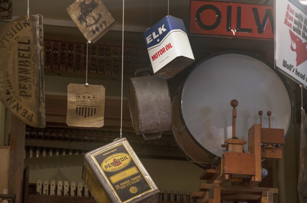
Venango County was created on March 12, 1800 from parts of Allegheny and Lycoming Counties. Its “Venango” comes from an approximation of the Native American name of the region, Onenge, meaning Otter. Oil is pulled from the ground and written all over Venango County. Yale University Chemistry professor George Bissell, and Edwin L. Drake, a former railroad conductor, made the first successful use of a drilling rig on August 28, 1859 near Titusville, Pennsylvania. Although the town of Titusville is in Crawford County, the first oil well was drilled outside of town, less than a mile inside of the Venango County boundary, giving Venango County bragging rights. Ida Tarbell’s (1857-1944) father made wooden barrels for oil and later became an oil producer and refiner. The family settled outside of Titusville about a mile inside Venango County. As a journalist Tarbell exposed unfair practices of the Standard Oil Company, leading to a U.S. Supreme Court decision to break its monopoly. The county seat is Franklin. The Oil Creek and Allegheny River meet just above Oil City. Once a center for a railroad and river based transportation, Oil City is now hoping to create a future in which it will capitalize on arts and tourism.
Union County : In Brief

Union County, formed in 1813 from part of Northumberland County, was home to a number of Indian nations prior to the arrival of the first settlers in the mid-1700’s. In the years that followed, the ‘Buffalo Valley’ became a key battleground in the French and Indian Wars. Finally, in 1768, the new Americans purchased the land from Native Americans in a deal made at Fort Stanwix. Northumberland, and then Union Counties, were formed. In the early 1830’s, the Western Branch of the Pennsylvania Canal was built along the Susquehanna River, establishing a key part of a much needed pathway to and from the ports of New York and Philadelphia. The region’s commercial future was secured. Iron ore was mined, crops were sold, the county grew in population. In 1855, Lewisburg became the county seat. Today many of Union County’s 36,000 residents still farm the rich Buffalo Valley.
Tioga County : In Brief

The Seneca Indian lands which became Tioga County were, during the 17th and 18th centuries, given to three different states on four separate occasions by three different English kings. Bounded to the north by New York, TIoga finally became a permanent part of Pennsylvania in the 1782 Decree of Trenton. Settlement in the region–slow due to rugged terrain, dense virgin forests and lack of navigable roads and waterways–picked up with passage of the 1804 Omnibus Bill breaking the expansive Lycoming County into five counties, of which Tioga was one. These new divisions encouraged and simplified settlement. The county’s population peaked in the 1890’s with the growth of the coal and lumber industries. Wellsboro, gateway to the Grand Canyon of Pennsylvania, became the county seat in 1806. It was named after Mary Wells, the wife of settler Benjamin Morrison. This was an easy choice: at the time they were the town’s only residents.
Somerset County : In Brief
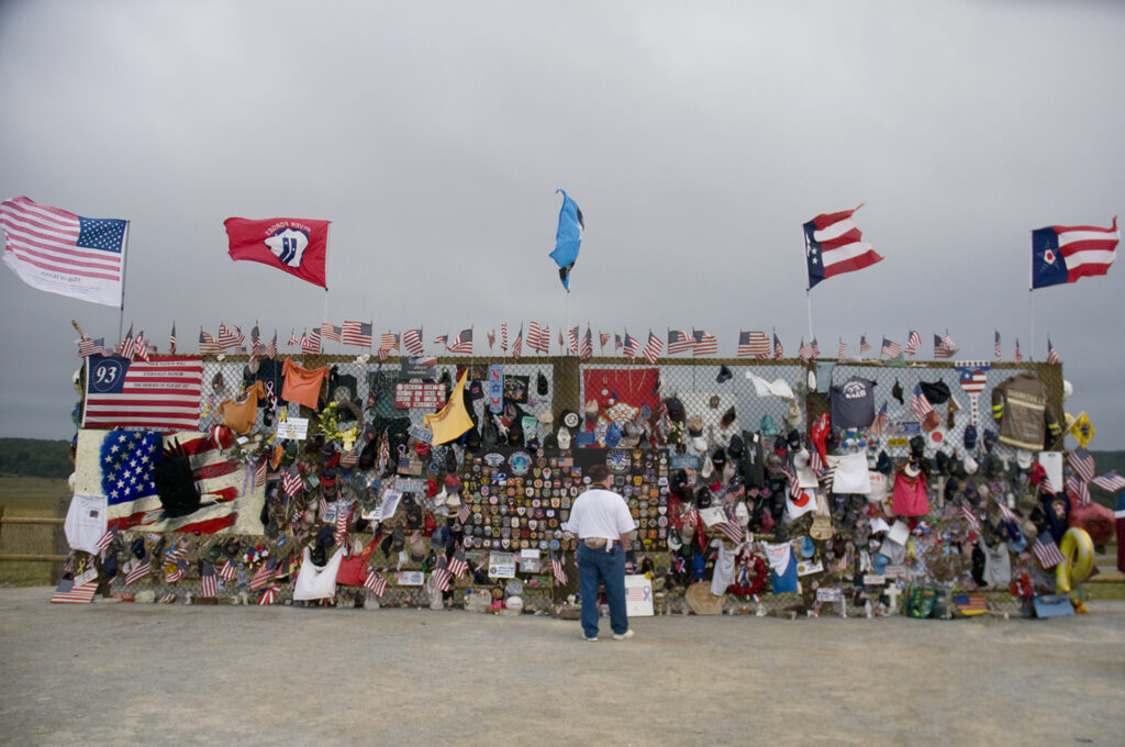
Settlers began to make their homes in the Somerset County region at the end of the French and Indian War, when a vast new section of provincial land was opened for legal settlement. Purchased from the Indians in 1768, the region was called the New Purchase or the Purchase of 1768. Somerset County was subsequenty created in 1795 from the western part of the already existing Bedford County. In 1804, the town of Somerset,located on the turnpike road from Bedford to Pittsburgh, was named its county seat. Agriculture was the dominant industry: the region supported cattle and sheep, and from the vast tracts of forested land came vast amounts of maple sugar. The Somerset and Cumberland Railroad opened in 1871, and big lumber and coal industries developed. Large scale mining operations began in 1872, and, as the lumber industry waned, coal production peaked. In 1920 Somerset mines produced 10.5 million tons of coal. This production was accompanied by labor strife, and there were violent coal strikes in 1903, 1906, and 1922. The 1936 flood eliminated the old wooden miners’ houses, and coal production gradually diminished. The development of the modern Pennsylvania Turnpike in the 1940’s brought tourists and revived the county’s economy. The highest elevation found in Pennsylvania is located in Somerset County at Mt. Davis, which is 3,213 feet above sea level. Somerset County is one of the snowiest inhabited locations in the United States, with parts of the county averaging 200+ inches of snow each winter, making it a prime ski area. Somerset County gained worldwide attention with the tragic 9-11 crash of United Airlines Flight 93 in Shanksville. Less than a year later, Somerset County again made news when tragedy was averted and nine coal miners were improbably and dramatically rescued from the Quecreek Mine.
Potter County : In Brief

Potter County, located in north central Pennsylvania, was created in 1804, on the same day as Tioga and McKean counties, all cut from the unmanageable Lycoming County to make it more manageable. The county was named for General James Potter, a hero of the Revolutionary War. Massive forests discouraged settlement, and despite the building, in 1807, of an east-west road, the official population count, was, in 1810, still only twenty-three. Potter County was legally attached to Lycoming and Mckean Counties till 1835, when it was fully recognized. Coudersport, the county seat since 1807, was fully incorporated in 1848. Commercial lumbering began in 1837, courtesy of vast forests of white pine, hemlock and hardwoods. Railroads, sawmills, tanneries grew up around lumber towns, but by the late 1800’s, the virgin white pines had been all but decimated, and the populace turned to the production of acetate, wood alcohol and charcoal. During the Civil War, several Potter County towns were important stops along the underground railroad. Two prominent Millport businessmen, brothers John S. and Joseph Mann, were among those who played critical roles in helping runaway slaves en route to New York and Canada. An undetectable, hidden room at the back of Joseph Mann’s store became a hiding place for many along that railroad. Paper mills, glass manufacturing, farming and deep gas drilling served the county through much of the 20th century. In recent years, Potter County has become a destination point for those wishing to visit its deep forests, brilliant night skies and stunning mountaintop views. From the ‘Potter County Triple Divide Point,’ on the eastern Continental Divide, water flows north to the Great Lakes, south to the Ohio and Mississippi, and east to the Altantic.